Trekking in Pu Luong is less about reaching a famous summit and more about seeing how life unfolds across northern Vietnam’s mountain valleys. The main challenge is choosing a route that matches your fitness, the weather and the time you have available. Pu Luong’s walking paths connect villages, farmland and forest rather than following one standard, clearly marked trail network.
Distances and walking times can vary between itineraries, so the important thing is you need to expect from the main trekking areas, when to go, what to bring and how to plan a walk that suits your trip.
Is trekking in Pu Luong suitable for beginners?
Yes. Pu Luong has relatively gentle village walks as well as longer routes involving steep slopes, uneven forest tracks and substantial elevation changes. Beginners do not need to attempt a mountain summit to enjoy the area, just a half-day walk through the rice terraces and nearby villages can provide a rewarding introduction to trekking.
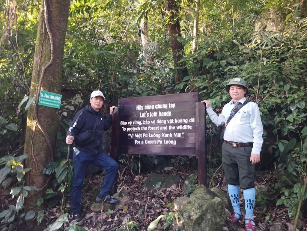
It is possible for newbie at the first of trekking (Source: TTXVN)
However, an easy rating does not mean the path will be smooth or flat throughout. You may encounter muddy sections after rain, slippery steps between terraces, narrow tracks beside cultivated fields and uphill stretches that feel harder than the distance suggests. According to the sharing of someone who has more trekking in Pu Luong experience, if this is your first trek, choose a route based on terrain and elevation rather than kilometres alone.
The experience also differs from hiking in a remote wilderness. Many paths pass through inhabited villages and working farmland, where residents may be farming, transporting goods or going about their daily routines. Walking with a local guide can help you navigate less obvious junctions and understand the places you pass without treating everyday village life as a tourist attraction.
What is the best trekking route in Pu Luong?
Pu Luong’s routes are often combined or adjusted to suit a traveller’s schedule, so the figures below should be treated as planning estimates rather than fixed trail specifications. Confirm the starting point, finishing point, walking distance and current conditions with your local guide before setting out, especially if you want to combine several villages in one day.
Ban Don - Ban Uoi - Ban Lan: The best starting point for beginners
The walk connecting Ban Don, Ban Uoi and Ban Lan is a good place to start if you want to see Pu Luong’s characteristic rice terraces and village scenery without planning a strenuous mountain hike. Depending on the route chosen, the walk may follow narrow paths between fields, descend into the valley and pass traditional stilt houses before continuing towards another village.
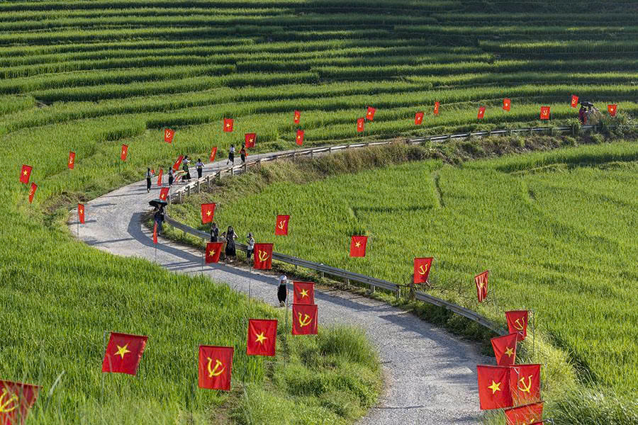
Ban Don, Uoi, and Lan (Source: VietNamNet)
The scenery changes with the rice-growing season, but the appeal is not limited to the views. You may see farmers working in the fields, domestic animals moving around village lanes and residents going about their everyday routines. These encounters are a reminder that the trails are part of a living agricultural landscape, not simply paths created for visitors.
Allow around three to four hours as an initial planning estimate, then adjust according to your pace and the route your guide proposes. Some versions are shorter, while extended walks can cover considerably more ground; ask whether the quoted distance includes the return journey and any uphill sections.
Read more: A green haven between Pu Luong and Mai Chau
This route is particularly suitable for travellers who want time for photographs and village stops rather than a continuous workout. If you have limited trekking experience, tell your guide in advance so the pace and route can be adjusted without rushing through the walk.
Ban Hieu: Village paths and waterfall scenery
The Ban Hieu area offers a different perspective on Pu Luong, combining village life, forested slopes and the natural scenery around Hieu Waterfall. Depending on recent rainfall and the route selected, a walk here may include uneven paths, steps and sections that become slippery near streams or on shaded ground.
This area works well for travellers who want to combine walking with time by the water. However, do not assume that every itinerary described as a “Ban Hieu trek” includes a visit to the waterfall itself; confirm the route, access conditions and amount of walking involved before booking.

Ban Hieu, Kho Muong (Source: Lao Dong Newspaper)
Rainfall affects both the scenery and the practical experience. Water levels may be more impressive after rain, but wet paths can make the walk slower and less comfortable, so footwear with reliable grip is more useful than ordinary fashion trainers.
If you are planning to visit the waterfall, ask your guide whether the current conditions are suitable for walking around it. Avoid entering fast-flowing water or climbing onto wet rocks for photographs, even when the area appears quiet.
Kho Muong Valley: A longer walk into the mountains
Kho Muong is known for its setting among limestone mountains and its relatively secluded village landscape. Reaching the valley on foot can involve a more demanding approach than a short walk around the rice terraces, particularly where the trail descends steeply or passes through forest.
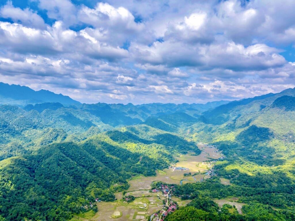
Kho Muong route, Pu Luong Peak (Source: VNA)
This route is better suited to travellers who are comfortable walking for several hours on uneven ground. Before choosing it, ask how much of the route is uphill or downhill, whether the trail becomes muddy after rain and how long it usually takes to return to your accommodation. These details are more useful for judging difficulty than a distance estimate on its own.
Important safety note about Hang Doi (Bat Cave): As of September 2026, authorities in Pu Luong suspended visits to the cave after reports of falling rocks and concerns about unstable ground. Do not include cave entry in your itinerary unless the relevant authorities have formally confirmed that access has reopened; a village route to Kho Muong does not automatically mean the cave is safe to enter (Source: Tuoi Tre News)
You can still discuss a walk through the surrounding valley with a local guide, provided the route avoids restricted or hazardous areas. Confirm the current access arrangements before travelling, as safety restrictions may change after inspections.
Read more: Top 5 things to know before visiting Kho Muong Bat Cave
Ban Uoi - Ban Lan: A quieter village walk
A shorter walk between Ban Uoi and Ban Lan can suit travellers who prefer to spend more time observing the landscape than covering a long distance. Depending on the route, the path may pass through cultivated slopes, shaded sections and village lanes, with opportunities to stop for photographs or a break.
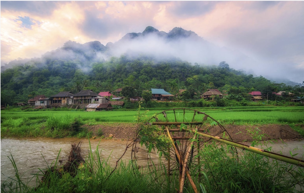
Ban Uoi and Ban Lan area (Source: Enterprise and Marketing Online Magazine)
Although this walk may be shorter than a full-day trek, it should not automatically be considered easy for everyone. Narrow paths, uneven ground and short climbs can still be tiring, particularly during hot weather or after rain.
This is a practical option if you have already spent time travelling to Pu Luong and want to keep the day relaxed. Ask your guide whether the walk can be arranged as a one-way route with transport at the finish, or whether you will need to retrace your steps.
Ban Don - Ban Bang
The Ban Don and Ban Bang area is worth considering if you want a more relaxed outing focused on valley scenery and photography. Depending on the route, you can combine village paths with nearby roads and viewpoints without committing to a full day on steep mountain trails.
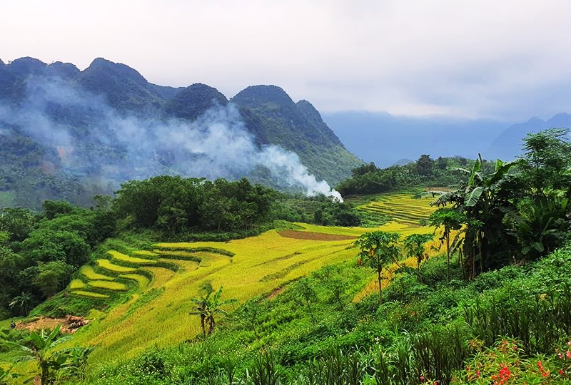
Ban Don and Ban Bang routes (Source: Collected)
The appearance of the rice fields changes noticeably through the year, so the same route can look very different from one visit to the next. Water in the paddies, fresh green shoots and ripening rice each create a different landscape, although the exact timing depends on local planting and harvesting schedules.
For photography, early morning often offers softer light and a quieter atmosphere than the middle of the day. Even so, avoid stepping into cultivated fields or blocking narrow access paths to get a better angle, as these areas remain part of local working life.
How to choose the right Pu Luong trekking route
The best route depends on more than fitness. Your available time, tolerance for steep or slippery paths, interest in village life and willingness to walk in changing weather all affect which itinerary will be most enjoyable.
Use the following guide as a starting point, then confirm the details with someone familiar with the current trail conditions.
|
Your travel style
|
A suitable starting point
|
What to confirm
|
|
First trek or limited fitness
|
Ban Don - Ban Uoi Ban Lan
|
Total walking time, steep sections and return transport
|
|
Interested in waterfalls
|
Ban Hieu area
|
Waterfall access, rainfall and path conditions
|
|
Prefer a longer mountain walk
|
Kho Muong valley approach
|
Elevation changes, route length and guide arrangements
|
|
Want a shorter, relaxed outing
|
Ban Uoi - Ban Lan
|
Whether the path includes steep or muddy sections
|
|
Mainly interested in landscapes and photos
|
Ban Don and nearby valley routes
|
Best time of day and safe places to stop
|
If you are travelling with children, older relatives or people with limited mobility, explain this before the itinerary is confirmed rather than trying to shorten the walk once you are already on the trail. However, local guides advise that trekking is not suitable for the elderly or children; you should suggest other forms of recreation for them that are gentler, more appropriate, and safe for their health.
Read more: Best water activities in Hoa Binh Lake: A guide for visitors
Best time for trekking in Pu Luong
Pu Luong can be visited throughout much of the year, but the experience changes with the rice-growing calendar and the weather. For most travellers, the decision is a balance between the landscape they want to see and the trail conditions they are comfortable handling.
May to June: Water in the rice terraces and fresh green fields
May and June are often associated with the early rice-growing season, when water-filled terraces and fresh green shoots create strong contrasts across the valleys. This is a good period for travellers who want to photograph the agricultural landscape rather than wait for golden rice.
Temperatures can be warm, and exposed paths may feel tiring around midday. Start early, carry enough water and allow extra time for breaks if your route involves long uphill sections.
July to August: Lush scenery, with greater rain risk
The summer months can bring dense greenery and a full, tropical appearance to the valleys. However, heavier rain can leave earth paths muddy and stone steps slippery, while thunderstorms may make longer forest walks less comfortable or unsafe.
If you travel during this period, keep your schedule flexible and check the forecast before setting out. A shorter village walk may be a better choice than a remote route if rain has affected the trails.

A review of guest on Tripadvisor
September to October: Rice harvest and golden terraces
September and October are popular months for seeing ripening rice and golden terraces, although the exact harvest period varies between villages and fields. This is a strong choice for travellers whose main interest is landscape photography, but the timing of the harvest should not be treated as identical across the whole reserve.
Book accommodation and guided activities in advance if you are travelling during a busy period. Early starts can help you make the most of the light and avoid the hottest part of the day.
November to January: Cooler walks and quieter landscapes
The cooler months can be comfortable for walking, especially for travellers who prefer lower temperatures to summer heat. The rice fields may not be at their greenest or most golden, but the quieter atmosphere can make village walks appealing.
Mornings and evenings may feel cold, and mist or cloud can reduce visibility in the hills. Bring an extra layer and check the forecast if your itinerary includes a viewpoint or a longer forest route.
February to April: Spring greenery and variable weather
Spring brings changing shades of green as the landscape moves into another growing season. Conditions can vary, so it is worth checking what the fields look like locally rather than choosing your dates based on a photograph from a previous year.
For a comfortable trek, prioritise the day’s forecast and trail condition over the month alone. A clear, dry day can make a moderate route far more enjoyable than a longer walk after heavy rain.
What to pack for trekking in Pu Luong
Packing for Pu Luong is less about carrying specialist hiking gear and more about preparing for changing trail conditions. A village walk on a dry morning can feel very different from a forest path after rain, so think about where you will walk, how long you will be out and whether you will finish at the same place you started.
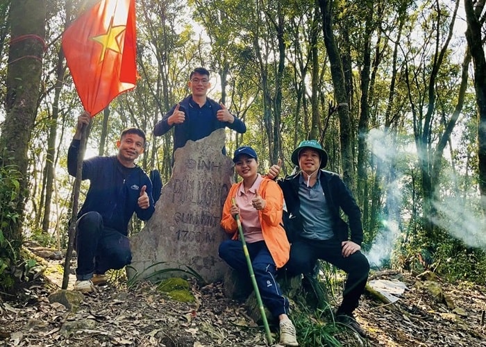
What do you need to remember to bring when trekking in Pu Luong? (Source: Vietnam News)
- Choose footwear for muddy paths, not just distance: Some routes combine village lanes with uneven earth tracks, steep steps and narrow paths between rice terraces. Shoes with reliable grip are more useful than lightweight trainers with smooth soles, and a spare pair of socks can make the return journey more comfortable if your feet get wet.
- Keep your day bag small, but plan for the whole route: Carry drinking water, a snack for longer walks, sun protection, insect repellent and a light rain jacket that is easy to reach. If your trek finishes in a different village, arrange luggage storage and pickup in advance rather than carrying your main bag along the trail.
- Prepare for limited connectivity: Charge your phone before leaving, save your accommodation and guide’s contact details, and download an offline map if a reliable route map is available. A small power bank can help on longer walks, but do not rely on your phone as a substitute for a local guide on unfamiliar trails.
Finally, carry a small bag for rubbish and ask before photographing people in the villages. These are simple preparations, but they make a trek more comfortable for you and more considerate of the communities whose paths and farmland you are visiting.
Safety and responsible trekking in Pu Luong
Most problems on a trek begin with a mismatch between the chosen route and the conditions on the day. A path that feels manageable when dry may become slippery after rain, and a short distance can take much longer if it includes steep descents, frequent stops or difficult footing.
Check the weather before leaving and be willing to change the plan if conditions deteriorate. Avoid pushing on towards a remote section simply because it was part of the original itinerary, and do not enter caves, cross fast-flowing streams or approach unstable slopes when access is restricted or conditions are unsafe.

Important tips for safe trekking in Pu Luong (Source: Vietnam News)
A local guide can help with navigation and route choices, particularly where paths divide between fields or villages. When arranging a guide, discuss your fitness level, preferred pace and any concerns in advance, and ask for a clear estimate of the walking time rather than only the distance.
Respect for local communities matters just as much as preparation. Stay on paths where possible, ask before photographing people at close range, avoid entering private homes or cultivated plots without permission, and take all rubbish back with you. If you pass a village during working hours, remember that the people you meet are going about their daily lives rather than performing for visitors.
Can you combine Pu Luong trekking with a stay at Mai Chau Hideaway?
Yes, but it is important to plan the transfer and the walk as separate parts of the trip. Mai Chau and Pu Luong are often combined in a northern Vietnam itinerary, yet travelling between them takes time, and the actual journey depends on your route, road conditions and transport arrangements.
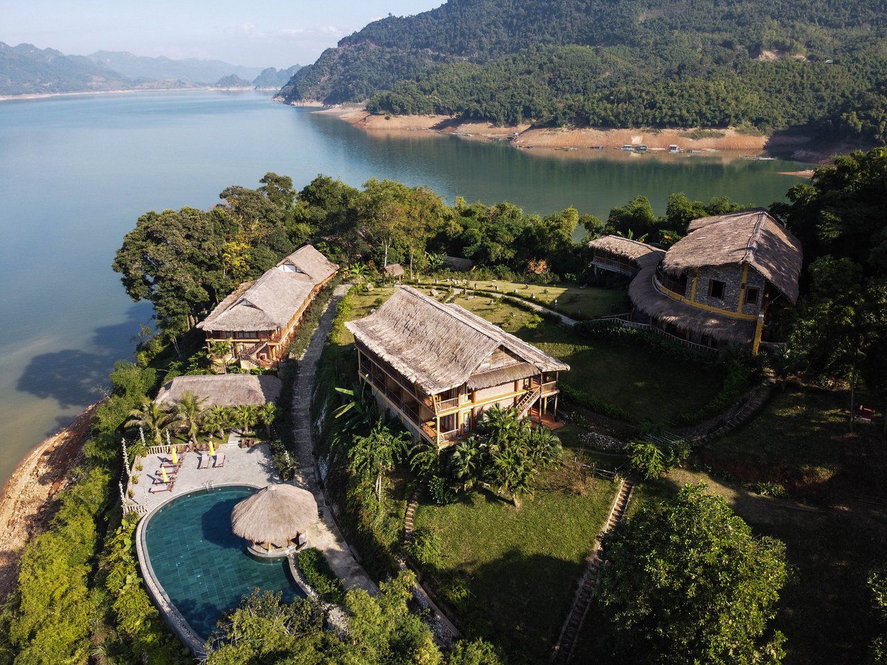
Mai Chau Hideaway Lake Resort
For travellers who want both walking and time to rest by the lake, a three-day itinerary can provide a balanced outline. The schedule below is a planning example rather than a fixed tour; confirm transfer times, the selected trek and availability with your accommodation or local operator before booking.
Read more: 3 Days 2 Nights: Daily Tour To Mai Chau - Kayaking – Cycling - Pu Luong Nature Reserve
Day 1: Arrive in Mai Chau and settle in
Travel from Hanoi to Mai Chau, then use the afternoon to rest after the journey. If you arrive with enough daylight and energy, a gentle walk or a short cycling outing can be a good introduction to the valley without taking on a demanding trek straight away.
.jpeg)
Accomodation at Mai Chau Hideaway Lake Resort
Stay overnight at Mai Chau Hideaway Lake Resort and prepare for the following day. Check the weather, organise suitable footwear and confirm your planned walking route before going to bed.
Day 2: Transfer to Pu Luong and trek through the villages
Leave for Pu Luong with enough time for the road journey and a short break before starting your walk. Choose a route such as Ban Don - Ban Uoi - Ban Lan if you want a village-and-terrace experience, or ask a local guide about a more suitable alternative if the weather or your fitness level calls for a shorter outing.
Allow time for lunch and rest rather than packing too many stops into one day. After the trek, return to your planned accommodation and keep the evening relaxed, especially if you have spent several hours on uneven paths.
Day 3: Enjoy Hoa Binh Lake and return to Hanoi
Spend the morning enjoying the lake setting at Mai Chau Hideaway, with time for a quiet breakfast or a suitable water-based activity if conditions and availability allow. Leave enough time for the return journey to Hanoi, particularly if you have a fixed departure or onward connection.

Kayaking on Hoa Binh Lake
This itinerary works best for travellers who want a taste of trekking without spending the entire trip on the trail. If your main goal is to explore more remote parts of Pu Luong on foot, consider staying longer in the area instead of trying to fit several long treks into a short visit.
FAQ about trekking in Pu Luong
Is trekking in Pu Luong difficult?
Not every trek is difficult, but conditions vary by route. Short walks through villages and rice terraces can suit beginners, while longer routes may include steep slopes, forest paths and slippery ground, particularly after rain.
How long does a typical Pu Luong trek take?
A short village walk may take around two to four hours, while a longer route can occupy most of the day. Ask for the total walking time and distance, including uphill sections, stops and the return journey, before choosing an itinerary.
Which Pu Luong trekking route is best for beginners?
The Ban Don Ban Uoi Ban Lan route is a useful starting point for many first-time trekkers because it combines valley scenery, rice terraces and village paths. However, the exact difficulty depends on the version of the route, so request a shorter itinerary if you are not used to walking on uneven ground.
Do I need a local guide for trekking in Pu Luong?
A local guide is strongly recommended if you are unfamiliar with the area, planning a longer forest walk or travelling in wet weather. Village paths do not always function like marked hiking trails, and a guide can help you choose a suitable route and respond to changing conditions.
Can I visit Hang Doi (Bat Cave) in Kho Muong?
Do not assume that the cave is open to visitors. Authorities suspended visits in September 2026 after reports of falling rocks and safety concerns, so check for an official reopening announcement before considering a visit.
What is the best month for trekking in Pu Luong?
May to June is often attractive for water-filled terraces and fresh green rice, while September to October is popular for golden fields near harvest time. If comfortable walking conditions matter more than the rice scenery, check the weather and trail conditions for your actual travel dates rather than relying on the season alone.
Can I visit Pu Luong on a day trip from Mai Chau?
It may be possible to visit part of Pu Luong on a day trip, but the time spent travelling reduces the time available for walking. If you want a longer trek, a village lunch and enough flexibility to respond to weather, an overnight stay closer to the route is usually more practical.

You need to carefully before trekking in Pu Luong for the best experience
Trekking in Pu Luong is best enjoyed when the route matches your pace and leaves room to notice the landscape along the way. A walk through the rice terraces and villages can be just as rewarding as a longer mountain route, provided you understand the terrain and plan around the weather.
For travellers combining Pu Luong with Mai Chau, Mai Chau Hideaway Lake Resort’s accommodation offers a lakeside base for relaxing between excursions. Plan your stay around the time you want to spend walking, and confirm transport and trekking arrangements in advance so the trip feels balanced rather than rushed.